 |
| DL/ON7DQ/P |
We spent a short holiday in the Moselle valley, in the village of Neumagen-Dhron, from 30/03 – 02/04/2023.
The weather
was a constant alternation of sun and rain. Still I managed to get three SOTA
activations in our limited schedule. ;-)
We left Ostend at the early hour of 05:40 local time on March 30th, took our breakfast along the road, and went to visit Bitburg first. By noon we arrived at the parking spot for DM/RP-412. We had our lunch at the picnic bench, the sun was shining ... and then we set off to the summit.
 |
| DM/RP-412 seen coming from Salmtal along the L141 |
DM/RP-412, Höhe Haardter Hochwald - 355m, 2 points (summit is also called Asberg)
 |
| Still lots of sunshine here ... (Burgberg in the background is not SOTA) |
For this summit, I had to rely on a preliminary track posted by Phil, G4OBK. Thanks Phil !
My actual track has been uploaded tot the SMP tracks page in the meantime.
 |
| Actual track to DM/RP-412 (source: OpenStreetMap) |
It seems Phil did a good job, since his track corresponds to what we walked, and we
reached the trig point on the summit in about 25 minutes. Nothing difficult,
except for the parts of the track that were very muddy, it had rained a lot in
previous days. But today the sun was shining, at least for now …
 |
| Typical view of the track, no cars have been here in a long time ... |
 |
| Found it ! |
I set up the short endfed antenna (9.15m), and started my activation.
 |
| Operating near the trig point |
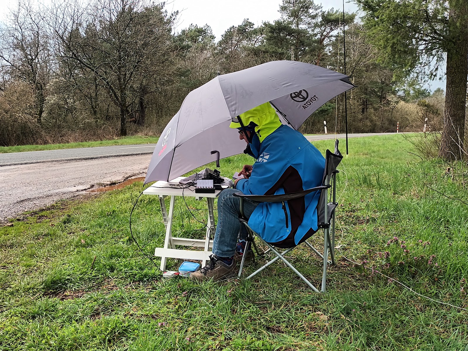
The fun didn’t last for long though, after 20 minutes operating CW on 20m, the rain started pouring down and although I had an umbrella, I chose to end the activation. Last caller was no one less than … G4OBK!
Only 17 QSO’s in the log, but I had at least catched two S2S thanks to OE7RGF
and EA5DD.
 |
| Under my umbrella ... |
When we arrived in our AirBnb, I had to disassemble my fishing pole, water came dripping out of it. Well, nothing a hair dryer can't fix ;-)
| Saving the fishing pole ! |
No SOTA on Friday, so the next activation was on Saturday April 1st.
DM/RP-150,
Kinheimer Berg - 420m, 2 points
In the morning we went shopping and had a brief visit of the old town of Bernkastel-Kues which is very nice. Here a few pictures.
 |
| View of the old city of Bernkastel-Kues, and the Castle Landshut |
 |
| The "Spitzhäuschen" (pointed house) at the market square |
After a lunch in one of the restaurants there, we went to the parking spot for Kinheimer Berg, which is in the AZ.
 |
| (source: Google Maps) |
The parking spot was all muddy, but the weather was dry, so I quickly set up my station a few steps from the car and started the activation.
 |
| Starting dry (sort of ...) |
It was not for long though, drizzle came up and I had to grab my umbrella again.
 |
| ... ending wet ! |
The YL stayed in the car and took this nice picture of me. Rain can be wonderful if you look at it from the dry side ;-)
 |
| Wet wet wet |
I started on 40m SSB and had quite a pile-up, followed by another one on 20m.
I finished by some QSO’s on 17m , both SSB and CW, with a nice DX call from K2LT in NY, who gave me a 339 report.
28 QSO’s here, and two S2S, with DL6FBK and OE5EEP.
DM/RP-466, Höhe
Piesport - 434m, 2 points
Sunday was
already the day to return home, but not without another summit.
We drove
the road from Neumagen-Dhron to Minheim, to access the ridge along the local
road K52.
This road
is much easier to drive than the endless hairpins of the L50 road from
Piesport.
Along the
K52, I had seen there was another road to the summit, starting at a
“Grillhütte” at position 49.887795,
6.934802. Alas, no luck, the forest road was forbidden (as was expected).
Google Maps
shows a “Moselpanorama” at this place, but we could not enjoy it .. there was a
dense fog all morning.
So we went to the official parking spot near the "Piesporter Heiligenhauschen" (see map)
 |
| Location of parking, shelter and summit (source: maps.rlp.de) |
 |
| Actual track to DM/RP-466 |
 |
| Looking back at the last part of the track |
The shelter is actually a chapel, and is called Minheimer Schutzhütte, it made an ideal shack to operate from. I used my own chair to sit, so as not to desecrate the chapel. I hope Mother Mary didn’t mind me making a few QSO’s there, maybe she even enjoyed me “talking to the skies” ?
 |
| Operating position, cold but dry |
The continuation of the track to the real summit looked more like a mud pool , so it was good that we didn’t have to walk it.
 |
| Swimming in the pool, anyone ? |
I had a big pileup on 40m SSB, and a smaller one on 20m CW. In 30 minutes, the log showed 38 QSO’s , with one S2S with CT1HIX.
After that
it was still a long drive home, we were back around 16:00 local time.
See you on
another trip soon !
73,
Luc ON7DQ