From Friedrichshafen to Freiburg
As my first summit, I chose an old friend ... an easy drive-up
DM/BW-193, Schächer - 921m, 10 points
Parking spot: 47.888481, 8.577659 (near the TV tower)
Walking time : none, just set up on the picnic bench near the parking spot.
Result: 31 QSO's and 12 S2S, 1 DX (EA8 again ...)
DM/BW-014, Weisstannenhöhe - 1190m, 10 pointsSince this summit is in the Südschwarzwald Nature Park , it is also valid for POTA, with reference DA-0004.
EDIT : as DL1HBT pointed out on the SOTA Summits Page, the long distance walkway E1 can also be activated here, it is POTA DE-0558 (Fernwanderweg E1 Deutschland State Trail). Namely the trajectory "10.09 Thurner - Feldberg" passes over the top of this summit, see here.
Parking spot: 47.929588, 8.127853
Walking time: difficult to tell ... since I had to do the walk twice, or almost ... read on!
I guess a normal walk will take some 30 minutes, as suggested by the Google Maps route.
I had studied the track by Markus @HB9BRJ, so I didn’t expect any problems.
I parked my car at the “Wanderparkplatz”, in position ‘1’ on the map below, and first ate my lunch.
Then I started walking and I wanted to go a little further than Markus, to the shelter near the summit, since that saved me from carrying a chair or table. So the intended track is seen below.
Just as I was at "point 1" on the above map, where I had to leave the gravel road and take a narrow and rocky forest track, a car came driving up the last part of the gravel road, honking like mad.
At first I thought they had some urgent business, and I stepped aside. But then the car halted, and a clearly excited lady asked if I was the owner of the car with the Belgian license plate.
Of course I was, and since I drove a brand new car, I thought “Oh no! Something happened to my car ?”
But no, the reason was something else. I had parked in front of some trees that were to be picked up that afternoon. The lady said “didn’t you see that you may not park there? It is clearly indicated in big letters on the trees!”.
Huh? I had not seen anything.
Anyway, the lady said “Get in, I’ll drive you down to the parking spot, to move your car”.
Now on that last part of gravel road it is impossible to turn a car, so she had to drive backward for a while until she could turn at point 2 on the map above. Then she drove at quite a dangerous speed to the parking lot. The car looked like a Citroen Berlingo (I forgot what brand it was), and had no airco, so I was sweating like hell.
While she was driving, she also got a phone call from her husband, who clearly was also nervous, and she shouted back at him “I found him, I found him!” ( in German of course).
At the parking, I looked for the sign she had talked about, and indeed , there were some crooked letters on the trees, painted with yellow paint, but the lady had to agree that the letters were hardly readable … Too bad I didn’t have the time to take a picture, since I needed to quickly move my car. It was OK to put it at position ‘2’ (on the first map above)).
But now comes the best part: the lady must have felt compassion for this old and sweaty man, carrying a heavy backpack … so she offered to drive me back to the point where she picked me up !
This is the first time I got a taxi ride to a summit (or at least part of the way). All in all, I may have lost only 15 minutes or so.
Being polite (as I always am, haha), I told her it was OK to drop me off at ‘point 2’ above, so that she could safely turn her car there.
After that, I reached the shelter without further interruptions and had a nice activation.
Result: 30 QSO's and 11 S2S, no DX
DM/BW-009, Kandel - 1241m, 10 pointsThis summit is also in the
Südschwarzwald Nature Park , it is valid for POTA, with reference
DA-0004.
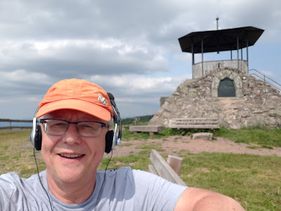
Parking position: 48.065336, 8.016146 , toilets available in a small separate building (to the left of above picture).
Walking time: 10 minutes, to a small lookout tower on the summit. There is a nice bench, but it's in the sun.
My setup:

At the parking spot, it was 'only' 21°C and it felt a bit cold, I think I was getting used to the 'near 30' temperatures ... so I was glad to have some sunshine at the summit ;-)
Result: 28 QSO's, that was nice, but I couldn't find any S2S station. Finally, it was Michael DB7MM/P who came to the rescue! So 1 S2S , and no DX. Don't get fooled by the map, I think DJ9BX probably hasn't set his coordinates right ...
After that it was time to go looking for my AirBnb near the only summit I had planned for the next day : DM/BW-115, Kaiserstuhl/Totenkopf.
Continue reading ... go to DAY 8
orGo back to overview HERE


No comments:
Post a Comment
All reactions will be moderated. Publicity or links to other sites are not allowed.